 vesseltracker.com
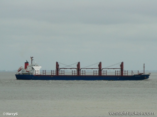
 Ken Giant
Current Status
Where is the vessel?
Ken Giant is currently in 231 nm SW of Harper, based on AIS data received less than 1h ago.
Latest AIS update:
Current position: 1.03432° N, 9.63997° W (231 nm SW of Harper)
Average speed (last 7 days): Loading…
Average speed (last 30 days): Loading…
Vessel profile: Ken Giant is a Bulk Carrier with dimensions 169m x 169m.
This page combines live AIS, route history, probable destination signals, nearby traffic, and port activity for practical vessel monitoring.
The current position of vessel Ken Giant is 1.03432 lat / -9.63997 lng. Updated: 2026-04-13 02:24:17 UTCNearest reference points:
- 160 nm S of Harper
- 98 nm SW of Harper
- Open sea, approx. 402 nm off the nearest listed port
Currently sailing under the flag of Liberia ![]()
Ken Giant built in 2009 year
Deadweight:
28323 tDetails:
Live Vessel Ken Giant Analytics (details, animations, etc.)
Recent AIS points (UTC):
2026-04-12 19:55:06 UTC · 0.14832, -8.72867 · SOG 11.8 kn · COG 315°2026-04-12 21:32:46 UTC · 0.36850, -8.95945 · SOG 11.2 kn · COG 315°
2026-04-12 23:14:16 UTC · 0.58815, -9.19060 · SOG 11.7 kn · COG 318°
2026-04-13 02:24:17 UTC · 1.03432, -9.63997 · SOG 12.1 kn · COG 318°