 vesseltracker.com
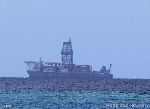
 Pacific Mistral
Current Status
Where is the vessel?
Pacific Mistral is currently in 46 nm SW of Boboras, based on AIS data received about 47d ago.
Latest AIS update:
Current position: 45.88138° N, 8.90003° W (46 nm SW of Boboras)
Average speed (last 7 days): Loading…
Average speed (last 30 days): Loading…
Vessel profile: Pacific Mistral is a Drilling Ship with dimensions 67m x 42m.
This page combines live AIS, route history, probable destination signals, nearby traffic, and port activity for practical vessel monitoring.
The current position of vessel Pacific Mistral is 45.88138 lat / -8.90003 lng. Updated: 2026-02-14 16:44:12 UTCNearest reference points:
- 57 nm S of Boboras
- 30 nm NW of Meiras-Valdoviño
- 58 nm SE of Rietheim-Weilheim
Currently sailing under the flag of Liberia ![]()
Details:
Live Vessel Pacific Mistral Analytics (details, animations, etc.)
Recent AIS points (UTC):
2026-02-14 16:44:12 UTC · 45.88138, -8.90003 · SOG 11.4 kn · COG 35°