 vesseltracker.com
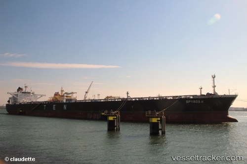
 Spyros K
Current Status
Where is the vessel?
Spyros K is currently in 76 nm SW of Southampton, based on AIS data received about 2h ago.
Latest AIS update:
Current position: 31.18516° N, 65.65424° W (76 nm SW of Southampton)
Average speed (last 7 days): Loading…
Average speed (last 30 days): Loading…
Vessel profile: Spyros K is a Crude Oil Tanker with dimensions 274m x 48m.
This page combines live AIS, route history, probable destination signals, nearby traffic, and port activity for practical vessel monitoring.
The current position of vessel Spyros K is 31.18516 lat / -65.65424 lng. Updated: 2026-04-16 13:29:11 UTCNearest reference points:
- 160 nm W of Sandys
Currently sailing under the flag of Liberia ![]()
Spyros K built in 2011 year
Deadweight:
157648 tDetails:
Live Vessel Spyros K Analytics (details, animations, etc.)
Recent AIS points (UTC):
2026-04-16 07:19:25 UTC · 30.57413, -66.95612 · SOG 12.8 kn · COG 62°2026-04-16 10:21:14 UTC · 30.88269, -66.30883 · SOG 12.2 kn · COG 59°
2026-04-16 11:31:27 UTC · 30.99694, -66.06248 · SOG 12.2 kn · COG 60°
2026-04-16 13:29:11 UTC · 31.18516, -65.65424 · SOG 12 kn · COG 59°