 vesseltracker.com
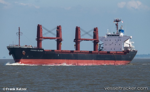
 Friendly Islands
Current Status
Where is the vessel?
Friendly Islands is currently in 110 nm NW of Ngatik, based on AIS data received less than 1h ago.
Latest AIS update:
Current position: 7.26311° N, 156.16617° E (110 nm NW of Ngatik)
Average speed (last 7 days): Loading…
Average speed (last 30 days): Loading…
Vessel profile: Friendly Islands is a Bulk Carrier with dimensions 169m x 27m.
This page combines live AIS, route history, probable destination signals, nearby traffic, and port activity for practical vessel monitoring.
The current position of vessel Friendly Islands is 7.26311 lat / 156.16617 lng. Updated: 2026-04-20 21:32:10 UTCNearest reference points:
- 69 nm W of Ponape
Currently sailing under the flag of Liberia ![]()
Friendly Islands built in 2012 year
Deadweight:
28387 tDetails:
Live Vessel Friendly Islands Analytics (details, animations, etc.)
Recent AIS points (UTC):
2026-04-20 18:14:07 UTC · 7.64562, 155.64706 · SOG 12.3 kn · COG 125°2026-04-20 19:22:56 UTC · 7.51291, 155.83447 · SOG 11.7 kn · COG 126°
2026-04-20 19:30:40 UTC · 7.49800, 155.85478 · SOG 11.5 kn · COG 127°
2026-04-20 21:32:10 UTC · 7.26311, 156.16617 · SOG 11.2 kn · COG 127°