 vesseltracker.com
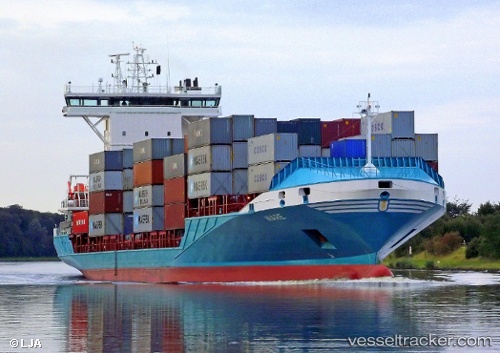
 Seaboard Atlantic
Current Status
Where is the vessel?
Seaboard Atlantic is currently in 127 nm W of Arawa, based on AIS data received about 29d ago.
Latest AIS update:
Current position: 6.91789° S, 153.53584° E (127 nm W of Arawa)
Average speed (last 7 days): Loading…
Average speed (last 30 days): Loading…
Vessel profile: Seaboard Atlantic is a Container Ship with dimensions 139m x 22m.
This page combines live AIS, route history, probable destination signals, nearby traffic, and port activity for practical vessel monitoring.
The current position of vessel Seaboard Atlantic is -6.91789 lat / 153.53584 lng. Updated: 2026-03-23 20:08:33 UTCNearest reference points:
- 15 nm SW of Lambom Island
Currently sailing under the flag of Liberia ![]()
Seaboard Atlantic built in 2009 year
Deadweight:
11007 tDetails:
Live Vessel Seaboard Atlantic Analytics (details, animations, etc.)
Recent AIS points (UTC):
2026-03-23 20:08:33 UTC · -6.91789, 153.53584 · SOG 0.4 kn · COG 231°