 vesseltracker.com
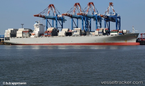
 Kea
Kea
Current Status
Where is the vessel?
Kea is currently in 39 nm NW of TENES, based on AIS data received less than 1h ago.
Latest AIS update:
Current position: 36.99612° N, 0.76260° E (39 nm NW of TENES)
Average speed (last 7 days): Loading…
Average speed (last 30 days): Loading…
Vessel profile: Kea is a Container Ship with dimensions 270m x 42m.
This page combines live AIS, route history, probable destination signals, nearby traffic, and port activity for practical vessel monitoring.
The current position of vessel Kea is 36.99612 lat / 0.76260 lng. Updated: 2026-04-17 10:10:50 UTCNearest reference points:
- 50 nm N of Mostaganem
- 43 nm NW of Mostaganem
- 49 nm S of Rejected
Currently sailing under the flag of Liberia ![]()
Kea built in 2013 year
Deadweight:
80229 tDetails:
Live Vessel Kea Analytics (details, animations, etc.)
Recent AIS points (UTC):
2026-04-17 03:45:37 UTC · 37.31596, 2.65440 · SOG 14.6 kn · COG 252°2026-04-17 05:36:01 UTC · 37.21831, 2.10815 · SOG 14.5 kn · COG 262°
2026-04-17 08:27:55 UTC · 37.08798, 1.26565 · SOG 14.1 kn · COG 255°
2026-04-17 10:10:50 UTC · 36.99612, 0.76260 · SOG 14.6 kn · COG 256°