 vesseltracker.com
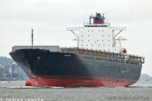
 Venetiko
Current Status
Where is the vessel?
Venetiko is currently in 11 nm NE of Hunsdon, based on AIS data received about 1h ago.
Latest AIS update:
Current position: 51.89294° N, 3.51512° E (11 nm NE of Hunsdon)
Average speed (last 7 days): Loading…
Average speed (last 30 days): Loading…
Vessel profile: Venetiko is a Container Ship with dimensions 280m x 280m.
This page combines live AIS, route history, probable destination signals, nearby traffic, and port activity for practical vessel monitoring.
The current position of vessel Venetiko is 51.89294 lat / 3.51512 lng. Updated: 2026-03-31 06:16:29 UTCNearest reference points:
- 12 nm NE of Hunsdon
- Near Hunsdon
- Near NEELTJE JANS
Currently sailing under the flag of Liberia ![]()
Venetiko built in 2003 year
Deadweight:
67009 tDetails:
Live Vessel Venetiko Analytics (details, animations, etc.)
Recent AIS points (UTC):
2026-03-30 23:52:40 UTC · 51.89565, 3.51890 · SOG 0.1 kn · COG -1°2026-03-31 01:58:39 UTC · 51.89609, 3.51881 · SOG 0 kn · COG -1°
2026-03-31 03:25:32 UTC · 51.89515, 3.51907 · SOG 0.1 kn · COG 271°
2026-03-31 06:16:29 UTC · 51.89294, 3.51512 · SOG 0 kn · COG 358°