 vesseltracker.com
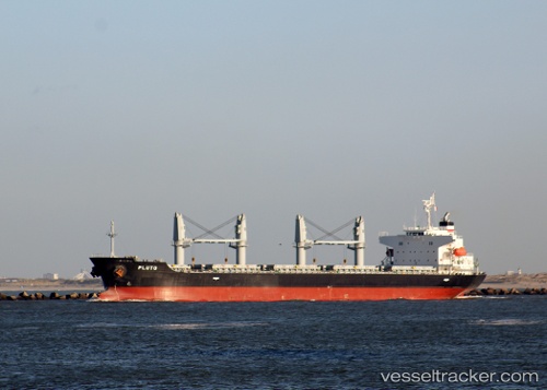
Vessel Pluto IMO: 9432531, MMSI: 636016416 Bulk Carrier
UTC, -6.78333, -32.58833, course: -1, speed: 11
UTC, -7.19500, -32.78333, course: -1, speed: 12
2026-02-27 18:27:18 UTC, -7.61523, -32.98268, course: 207, speed: 12.1
Live AIS position:
UTC. 109 nm E of Ilha de Itamaracá),
updated 2026-02-27 18:27:18 UTC.
Find the position of the vessel Pluto on the map. The latter are known coordinates and path.
marine traffic ship tracker show on live map
The current position of vessel Pluto is -7.61523 lat / -32.98268 lng. Updated: 2026-02-27 18:27:18 UTCCurrently sailing under the flag of Liberia
Details:
Last coordinates of the vessel:
UTC, -6.52170, -32.45633, course: 205, speed: 11.6UTC, -6.78333, -32.58833, course: -1, speed: 11
UTC, -7.19500, -32.78333, course: -1, speed: 12
2026-02-27 18:27:18 UTC, -7.61523, -32.98268, course: 207, speed: 12.1