 vesseltracker.com
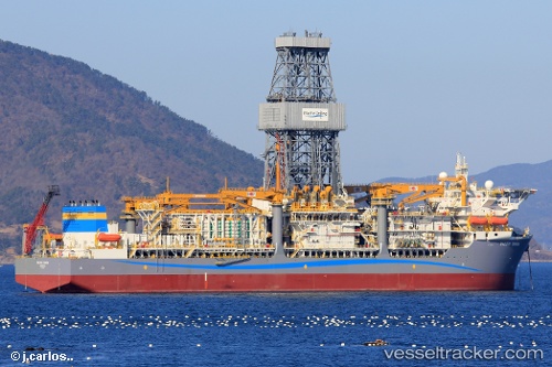
 ATLANTIC ZONDA
Current Status
Where is the vessel?
ATLANTIC ZONDA is currently in 15 nm E of Fluminense FPSO, based on AIS data received less than 1h ago.
Latest AIS update:
Current position: 22.65891° S, 40.14082° W (15 nm E of Fluminense FPSO)
Average speed (last 7 days): Loading…
Average speed (last 30 days): Loading…
Vessel profile: ATLANTIC ZONDA is a Other Type with dimensions m x m.
This page combines live AIS, route history, probable destination signals, nearby traffic, and port activity for practical vessel monitoring.
The current position of vessel ATLANTIC ZONDA is -22.65891 lat / -40.14082 lng. Updated: 2026-03-29 09:36:44 UTCNearest reference points:
- Near Fluminense FPSO
- Near PORTO DO ACU
- 24 nm SE of Carapebus
Currently sailing under the flag of Liberia ![]()
Details:
Live Vessel ATLANTIC ZONDA Analytics (details, animations, etc.)
Recent AIS points (UTC):
2026-03-29 04:08:01 UTC · -22.65891, -40.14078 · SOG 0 kn · COG 120°2026-03-29 05:37:26 UTC · -22.65888, -40.14078 · SOG 0.1 kn · COG 120°
2026-03-29 08:21:03 UTC · -22.65888, -40.14083 · SOG 0.1 kn · COG 120°
2026-03-29 09:36:44 UTC · -22.65891, -40.14082 · SOG 0 kn · COG 120°