 vesseltracker.com
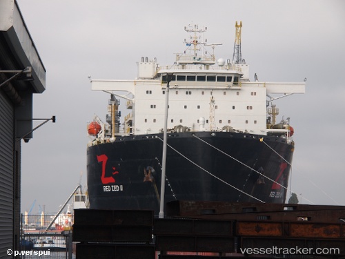
 Red Zed Ii
Current Status
Where is the vessel?
Red Zed Ii is currently in Near Wu-Sung, based on AIS data received less than 1h ago.
Latest AIS update:
Current position: 31.40104° N, 121.64643° E (Near Wu-Sung)
Average speed (last 7 days): Loading…
Average speed (last 30 days): Loading…
Vessel profile: Red Zed Ii is a Heavy Load Carrier with dimensions 217m x 43m.
This page combines live AIS, route history, probable destination signals, nearby traffic, and port activity for practical vessel monitoring.
The current position of vessel Red Zed Ii is 31.40104 lat / 121.64643 lng. Updated: 2026-04-03 17:38:56 UTCNearest reference points:
- Near Wu-Sung
- Near Gonglu
- Near Jinqiao
Currently sailing under the flag of Liberia ![]()
Details:
Live Vessel Red Zed Ii Analytics (details, animations, etc.)
Recent AIS points (UTC):
2026-04-03 11:38:55 UTC · 31.40117, 121.64650 · SOG 0 kn · COG 308°2026-04-03 13:59:55 UTC · 31.40108, 121.64641 · SOG 0 kn · COG 307°
2026-04-03 15:26:55 UTC · 31.40106, 121.64653 · SOG 0.1 kn · COG 306°
2026-04-03 17:38:56 UTC · 31.40104, 121.64643 · SOG 0 kn · COG 307°