 vesseltracker.com
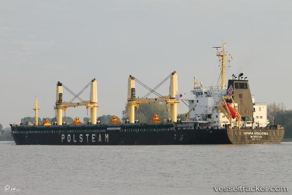
 Armia Krajowa
Current Status
Where is the vessel?
Armia Krajowa is currently in Near Algiers, based on AIS data received about 2h ago.
Latest AIS update:
Current position: 36.79841° N, 3.07392° E (Near Algiers)
Average speed (last 7 days): Loading…
Average speed (last 30 days): Loading…
Vessel profile: Armia Krajowa is a Bulk Carrier with dimensions 180m x 30m.
This page combines live AIS, route history, probable destination signals, nearby traffic, and port activity for practical vessel monitoring.
The current position of vessel Armia Krajowa is 36.79841 lat / 3.07392 lng. Updated: 2026-04-06 13:22:27 UTCNearest reference points:
- Near Algiers
- 16 nm NE of Berja
- 17 nm S of Albanchez
Currently sailing under the flag of Liberia ![]()
Details:
Live Vessel Armia Krajowa Analytics (details, animations, etc.)
Recent AIS points (UTC):
2026-04-06 04:19:28 UTC · 36.79886, 3.07403 · SOG 0 kn · COG 116°2026-04-06 04:19:28 UTC · 36.79886, 3.07403 · SOG 0 kn · COG 116°
2026-04-06 12:10:26 UTC · 36.79810, 3.07391 · SOG 0 kn · COG 83°
2026-04-06 13:22:27 UTC · 36.79841, 3.07392 · SOG 0 kn · COG 96°