 vesseltracker.com
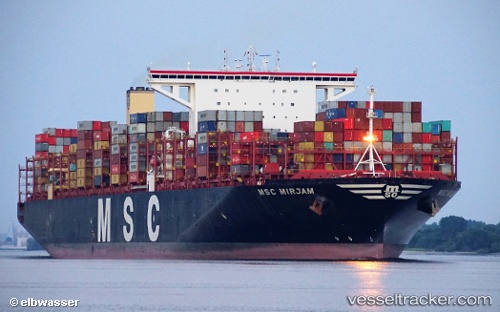
 Msc Mirjam
Current Status
Where is the vessel?
Msc Mirjam is currently in 165 nm W of River Sao Nicolau, based on AIS data received about 2h ago.
Latest AIS update:
Current position: 13.20882° S, 9.70753° E (165 nm W of River Sao Nicolau)
Average speed (last 7 days): Loading…
Average speed (last 30 days): Loading…
Vessel profile: Msc Mirjam is a Container Ship with dimensions 400m x 59m.
This page combines live AIS, route history, probable destination signals, nearby traffic, and port activity for practical vessel monitoring.
The current position of vessel Msc Mirjam is -13.20882 lat / 9.70753 lng. Updated: 2026-04-13 21:23:34 UTCCurrently sailing under the flag of Liberia ![]()
Details:
Live Vessel Msc Mirjam Analytics (details, animations, etc.)
Recent AIS points (UTC):
2026-04-13 15:25:11 UTC · -11.55381, 8.97897 · SOG 18 kn · COG 157°2026-04-13 17:48:22 UTC · -12.19737, 9.28784 · SOG 17.8 kn · COG 162°
2026-04-13 20:07:02 UTC · -12.85454, 9.55006 · SOG 18.3 kn · COG 157°
2026-04-13 21:23:34 UTC · -13.20882, 9.70753 · SOG 18.1 kn · COG 157°