 vesseltracker.com
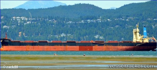
 Amigo Ii
Current Status
Where is the vessel?
Amigo Ii is currently in 28 nm SW of Gawa Island, based on AIS data received about 1h ago.
Latest AIS update:
Current position: 9.26081° S, 151.60809° E (28 nm SW of Gawa Island)
Average speed (last 7 days): Loading…
Average speed (last 30 days): Loading…
Vessel profile: Amigo Ii is a Bulk Carrier with dimensions 292m x 45m.
This page combines live AIS, route history, probable destination signals, nearby traffic, and port activity for practical vessel monitoring.
The current position of vessel Amigo Ii is -9.26081 lat / 151.60809 lng. Updated: 2026-03-30 05:37:59 UTCCurrently sailing under the flag of Liberia ![]()
Details:
Live Vessel Amigo Ii Analytics (details, animations, etc.)
Recent AIS points (UTC):
2026-03-29 23:45:18 UTC · -10.42005, 151.83144 · SOG 12.1 kn · COG 315°2026-03-30 02:25:30 UTC · -9.89904, 151.70663 · SOG 12.5 kn · COG 356°
2026-03-30 04:15:01 UTC · -9.53740, 151.64929 · SOG 11.9 kn · COG 355°
2026-03-30 05:37:59 UTC · -9.26081, 151.60809 · SOG 12.2 kn · COG 354°