 vesseltracker.com
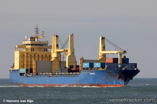
Yu Chang
Current StatusWhere is the vessel?
Yu Chang is currently in 52 nm W of Dehiwala, based on AIS data received about 2h ago.
Latest AIS update:
Current position: 6.68145° N, 78.99475° E (52 nm W of Dehiwala)
Average speed (last 7 days): Loading…
Average speed (last 30 days): Loading…
Vessel profile: Yu Chang is a Multi Purpose Carrier with dimensions 28m x 192m.
This page combines live AIS, route history, probable destination signals, nearby traffic, and port activity for practical vessel monitoring.
The current position of vessel Yu Chang is 6.68145 lat / 78.99475 lng. Updated: 2026-04-07 11:42:53 UTCNearest reference points:
- 67 nm SW of Moratuwa
- 82 nm W of Moratuwa
- 90 nm W of Moratuwa
Details:
Live Vessel Yu Chang Analytics (details, animations, etc.)
Recent AIS points (UTC):
2026-04-07 05:26:33 UTC · 6.94923, 79.85094 · SOG 1 kn · COG 28°2026-04-07 07:33:38 UTC · 6.94634, 79.60358 · SOG 9.3 kn · COG 256°
2026-04-07 09:47:33 UTC · 6.80455, 79.27488 · SOG 9.7 kn · COG 250°
2026-04-07 11:42:53 UTC · 6.68145, 78.99475 · SOG 9.5 kn · COG -1°