 vesseltracker.com
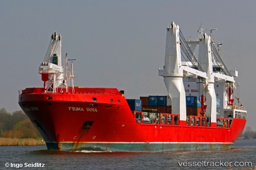
 ELARA
ELARA
Current Status
Where is the vessel?
ELARA is currently in 67 nm SW of Greenville, based on AIS data received less than 1h ago.
Latest AIS update:
Current position: 3.95667° N, 9.48333° W (67 nm SW of Greenville)
Average speed (last 7 days): Loading…
Average speed (last 30 days): Loading…
Vessel profile: ELARA is a General Cargo Ship with dimensions m x m.
This page combines live AIS, route history, probable destination signals, nearby traffic, and port activity for practical vessel monitoring.
The current position of vessel ELARA is 3.95667 lat / -9.48333 lng. Updated: 2026-04-06 02:06:43 UTCNearest reference points:
- 98 nm SW of Harper
- 110 nm SW of River Cess
- 15 nm SW of Buchanan
Currently sailing under the flag of Liberia ![]()
ELARA built in 2010 year
Deadweight:
16543 tDetails:
Live Vessel ELARA Analytics (details, animations, etc.)
Recent AIS points (UTC):
2026-04-05 17:41:51 UTC · 4.93304, -10.89068 · SOG 11.7 kn · COG 121°2026-04-05 20:27:47 UTC · 4.60500, -10.43167 · SOG 12 kn · COG -1°
2026-04-06 00:09:44 UTC · 4.17833, -9.81833 · SOG 12 kn · COG -1°
2026-04-06 02:06:43 UTC · 3.95667, -9.48333 · SOG 11 kn · COG -1°