 vesseltracker.com
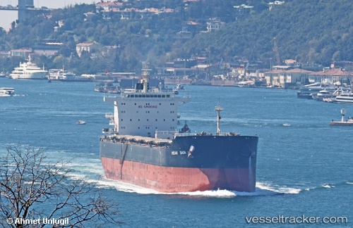
Ocean Saga
Current StatusWhere is the vessel?
Ocean Saga is currently in 167 nm NW of Port Mathurin, based on AIS data received about 2h ago.
Latest AIS update:
Current position: 17.13667° S, 62.22333° E (167 nm NW of Port Mathurin)
Average speed (last 7 days): Loading…
Average speed (last 30 days): Loading…
Vessel profile: Ocean Saga is a Bulk Carrier with dimensions 32m x 229m.
This page combines live AIS, route history, probable destination signals, nearby traffic, and port activity for practical vessel monitoring.
The current position of vessel Ocean Saga is -17.13667 lat / 62.22333 lng. Updated: 2026-04-09 17:50:10 UTCNearest reference points:
- 219 nm NW of Port Mathurin
- 106 nm NW of Port Mathurin
- 241 nm N of Port Mathurin
Details:
Live Vessel Ocean Saga Analytics (details, animations, etc.)
Recent AIS points (UTC):
2026-04-09 10:59:58 UTC · -18.05528, 61.19710 · SOG 11.9 kn · COG 48°2026-04-09 13:26:10 UTC · -17.72167, 61.57667 · SOG 11 kn · COG -1°
2026-04-09 15:29:09 UTC · -17.44167, 61.87500 · SOG 11 kn · COG -1°
2026-04-09 17:50:10 UTC · -17.13667, 62.22333 · SOG 11 kn · COG -1°