 vesseltracker.com
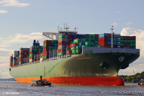
 Thalassa Mana
Current Status
Where is the vessel?
Thalassa Mana is currently in 373 nm SE of Suqutrá, based on AIS data received about 3h ago.
Latest AIS update:
Current position: 8.38309° N, 58.73124° E (373 nm SE of Suqutrá)
Average speed (last 7 days): Loading…
Average speed (last 30 days): Loading…
Vessel profile: Thalassa Mana is a Container Ship with dimensions 368m x 51m.
This page combines live AIS, route history, probable destination signals, nearby traffic, and port activity for practical vessel monitoring.
The current position of vessel Thalassa Mana is 8.38309 lat / 58.73124 lng. Updated: 2026-04-04 00:14:54 UTCNearest reference points:
- Open sea, approx. 401 nm off the nearest listed port
- Open sea, approx. 408 nm off the nearest listed port
- Open sea, approx. 412 nm off the nearest listed port
Currently sailing under the flag of Liberia ![]()
Thalassa Mana built in 2014 year
Deadweight:
131862 tDetails:
Live Vessel Thalassa Mana Analytics (details, animations, etc.)
Recent AIS points (UTC):
2026-04-03 18:41:43 UTC · 7.29476, 58.04652 · SOG 13.3 kn · COG 32°2026-04-03 20:36:15 UTC · 7.66363, 58.27106 · SOG 13.7 kn · COG 31°
2026-04-03 22:38:30 UTC · 8.06634, 58.52193 · SOG 14 kn · COG 33°
2026-04-04 00:14:54 UTC · 8.38309, 58.73124 · SOG 14.2 kn · COG 34°