 vesseltracker.com
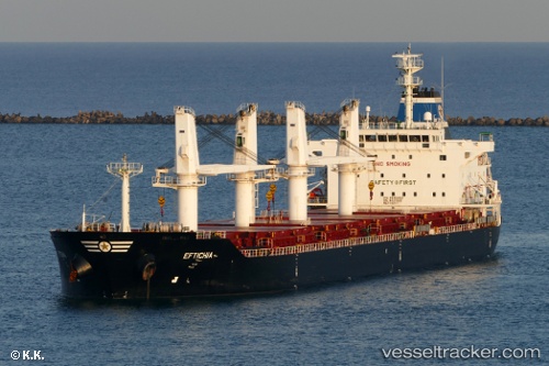
 HOPE
HOPE
Current Status
Where is the vessel?
HOPE is currently in 198 nm SE of Elvillar, based on AIS data received about 1h ago.
Latest AIS update:
Current position: 40.63025° N, 16.95393° W (198 nm SE of Elvillar)
Average speed (last 7 days): Loading…
Average speed (last 30 days): Loading…
Vessel profile: HOPE is a Bulk Carrier with dimensions 38m x 8m.
This page combines live AIS, route history, probable destination signals, nearby traffic, and port activity for practical vessel monitoring.
The current position of vessel HOPE is 40.63025 lat / -16.95393 lng. Updated: 2026-04-16 13:27:00 UTCCurrently sailing under the flag of Liberia ![]()
HOPE built in 2011 year
Deadweight:
34146 tDetails:
Live Vessel HOPE Analytics (details, animations, etc.)
Recent AIS points (UTC):
2026-04-16 07:55:41 UTC · 41.13953, -15.94619 · SOG 9.4 kn · COG 242°2026-04-16 09:45:30 UTC · 40.98346, -16.27944 · SOG 9.6 kn · COG 243°
2026-04-16 11:27:19 UTC · 40.82806, -16.58451 · SOG 10.1 kn · COG 234°
2026-04-16 13:27:00 UTC · 40.63025, -16.95393 · SOG 10.5 kn · COG 237°