 vesseltracker.com
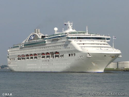
 CHARMING
Current Status
Where is the vessel?
CHARMING is currently in Near Aewol, based on AIS data received about 1h ago.
Latest AIS update:
Current position: 33.53375° N, 126.21778° E (Near Aewol)
Average speed (last 7 days): Loading…
Average speed (last 30 days): Loading…
Vessel profile: CHARMING is a Passenger (Cruise) Ship with dimensions 261m x 40m.
This page combines live AIS, route history, probable destination signals, nearby traffic, and port activity for practical vessel monitoring.
The current position of vessel CHARMING is 33.53375 lat / 126.21778 lng. Updated: 2026-04-22 23:44:05 UTCNearest reference points:
- 13 nm NW of Aewol
- Near Bukjeju-gun
- Near Hwasun
Currently sailing under the flag of Liberia ![]()
CHARMING built in 1998 year
Deadweight:
8293 tDetails:
Live Vessel CHARMING Analytics (details, animations, etc.)
Recent AIS points (UTC):
2026-04-22 19:51:54 UTC · 33.83909, 127.44212 · SOG 17.1 kn · COG 259°2026-04-22 21:24:44 UTC · 33.74167, 126.93333 · SOG 17 kn · COG -1°
2026-04-22 22:22:09 UTC · 33.66205, 126.63351 · SOG 16.1 kn · COG 250°
2026-04-22 23:44:05 UTC · 33.53375, 126.21778 · SOG 16.4 kn · COG 237°