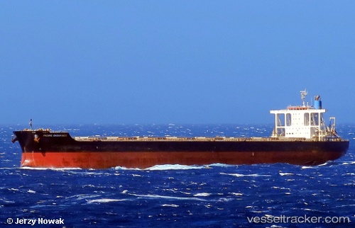
.
Vessel photo of PACIFIST (IMO 9573775) vesseltracker.com

LB flag PACIFIST

Vessel type: Bulk Carrier | IMO: 9573775 | MMSI: MMSI: 636020330
Call sign: D5YS6 | Dimensions: 292 m x 45 m
Current Status

Where is the vessel?

PACIFIST is currently in Open sea (no nearby ports in database), based on AIS data received less than 1h ago.

Latest AIS update:

Current position: 32.22816° S, 45.20765° E (Open sea (no nearby ports in database))

Average speed (last 7 days): Loading…

Average speed (last 30 days): Loading…

Vessel profile: PACIFIST is a Bulk Carrier with dimensions 292m x 45m.

This page combines live AIS, route history, probable destination signals, nearby traffic, and port activity for practical vessel monitoring.

The current position of vessel PACIFIST is -32.22816 lat / 45.20765 lng. Updated: 2026-04-16 21:21:53 UTC
Nearest reference points:
  • Open sea (no nearby ports in database)

Currently sailing under the flag of Liberia LB flag

PACIFIST built in 2011 year

Deadweight:
181458 t

Details:

Live Vessel PACIFIST Analytics (details, animations, etc.)


Recent AIS points (UTC):
2026-04-16 13:58:33 UTC · -32.49519, 43.67264 · SOG 10.2 kn · COG 73°
2026-04-16 15:45:11 UTC · -32.42594, 44.03847 · SOG 10.8 kn · COG 76°
2026-04-16 20:22:41 UTC · -32.26205, 45.01149 · SOG 10.7 kn · COG 80°
2026-04-16 21:21:53 UTC · -32.22816, 45.20765 · SOG 10.2 kn · COG 81°

Track of the vessel in the last 60 days


UTC: --
Start: -- Track timeline (UTC) End: --
Encountered: --


Link to the map:


Find another ship

PACIFIST (636020330) last ports (portcalls and passsages)

PULAU SAMBU | 2025-06-17 06:32:51
TANAH MERAH | 2025-06-15 21:09:46
PENGERANG | 2025-06-15 20:24:06
LANSHAN | 2025-05-30 00:00:36
PENGERANG | 2025-05-20 06:48:14
TANAH MERAH | 2025-05-18 23:04:53
BATU AMPAR | 2025-05-18 20:40:03
PULAU SAMBU | 2025-05-18 18:51:16
Sebang | 2025-05-16 03:56:40
Port Louis | 2025-05-05 10:31:12
PUERTO DE SALINETAS | 2025-04-08 02:08:01
TALIARTE | 2025-04-07 08:14:31
Puerto De La Luz | 2025-04-06 20:01:59
Grand Banks South | 2025-03-30 04:15:27
TANAH MERAH | 2025-01-21 07:54:04
PENGERANG | 2025-01-21 06:32:21
Nantong | 2025-01-11 06:46:13
Wusong | 2025-01-11 01:25:38
Jingjiang | 2025-01-10 20:12:16
PENGERANG | 2024-12-29 06:03:51
TANAH MERAH | 2024-12-29 05:18:07
PULAU SAMBU | 2024-12-29 03:31:36
BUKOM ISLAND | 2024-12-29 02:58:16
Sebang | 2024-12-26 18:23:38
SALDANHA | 2024-12-05 16:46:09
Saldanha Bay | 2024-12-05 13:27:24
Fujairah | 2024-11-19 05:10:23
Ponta Delgada | 2024-09-15 18:25:23
Ijmuiden | 2024-09-02 03:41:43
Ijmuiden | 2024-08-29 02:42:13
Gladstone Harbor | 2024-06-17 04:40:02
Nansha | 2024-05-19 10:06:23
Guangzhou | 2024-05-15 08:34:35
Nansha | 2024-05-15 07:36:17
Sambu | 2024-04-23 00:38:48
Port Louis | 2024-04-09 05:22:18
Sambu | 2024-01-23 17:42:37
Yosu | 2023-11-30 22:58:36
Pohang | 2023-11-21 09:00:13
Pohang | 2023-11-17 08:58:45
Tsugaru-Kaikyo | 2023-11-13 05:41:12
Vancouver | 2023-10-26 23:11:22
Vancouver | 2023-10-22 22:35:24
Victoria | 2023-09-30 18:04:24
Victoria | 2023-08-15 12:32:49
Vancouver | 2023-08-13 00:26:38
Vancouver | 2023-08-08 23:10:19
Prince Rupert | 2023-07-10 19:29:42
Singapore | 2023-06-02 14:58:47
Port Headland | 2023-01-08 14:19:53
Sitrah Anchorage | 2022-08-20 10:50:24
Sitrah Anchorage | 2022-08-10 19:05:12
Nansha | 2022-02-26 06:09:34