 vesseltracker.com
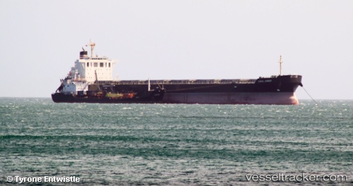
 STARDUST
Current Status
Where is the vessel?
STARDUST is currently in Near MONTOIR, based on AIS data received about 1h ago.
Latest AIS update:
Current position: 47.30334° N, 2.12500° W (Near MONTOIR)
Average speed (last 7 days): Loading…
Average speed (last 30 days): Loading…
Vessel profile: STARDUST is a Bulk Carrier with dimensions 32m x 221m.
This page combines live AIS, route history, probable destination signals, nearby traffic, and port activity for practical vessel monitoring.
The current position of vessel STARDUST is 47.30334 lat / -2.12500 lng. Updated: 2026-04-15 19:45:02 UTCNearest reference points:
- Near Arzal
- Near Camoël
- Near LE CROISIC
Currently sailing under the flag of Liberia ![]()
STARDUST built in 2012 year
Deadweight:
78072 tDetails:
Live Vessel STARDUST Analytics (details, animations, etc.)
Recent AIS points (UTC):
2026-04-15 13:39:10 UTC · 47.30332, -2.12497 · SOG 0 kn · COG 77°2026-04-15 15:45:07 UTC · 47.30335, -2.12496 · SOG 0 kn · COG 77°
2026-04-15 17:39:04 UTC · 47.30333, -2.12501 · SOG 0.1 kn · COG 76°
2026-04-15 19:45:02 UTC · 47.30334, -2.12500 · SOG 0 kn · COG 77°