 vesseltracker.com
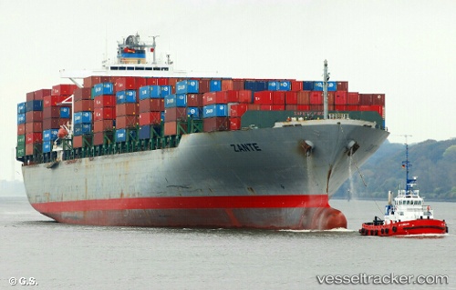
 PORTO KAGIO
Current Status
Where is the vessel?
PORTO KAGIO is currently in 34 nm NW of Kafr Kanna, based on AIS data received less than 1h ago.
Latest AIS update:
Current position: 32.98430° N, 35.97460° W (34 nm NW of Kafr Kanna)
Average speed (last 7 days): Loading…
Average speed (last 30 days): Loading…
Vessel profile: PORTO KAGIO is a Container Ship with dimensions 40m x 279m.
This page combines live AIS, route history, probable destination signals, nearby traffic, and port activity for practical vessel monitoring.
The current position of vessel PORTO KAGIO is 32.98430 lat / -35.97460 lng. Updated: 2026-04-07 05:53:56 UTCNearest reference points:
- 107 nm SE of Sariseki
Currently sailing under the flag of Liberia ![]()
PORTO KAGIO built in 2002 year
Deadweight:
67164 tDetails:
Live Vessel PORTO KAGIO Analytics (details, animations, etc.)
Recent AIS points (UTC):
2026-04-06 23:28:01 UTC · 33.38858, -33.62702 · SOG 19 kn · COG 259°2026-04-07 01:31:15 UTC · 33.25235, -34.37660 · SOG 19.1 kn · COG 258°
2026-04-07 04:15:55 UTC · 33.08948, -35.38338 · SOG 18.7 kn · COG 257°
2026-04-07 05:53:56 UTC · 32.98430, -35.97460 · SOG 18.2 kn · COG 258°