 vesseltracker.com
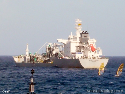
 TELLUS
Current Status
Where is the vessel?
TELLUS is currently in 64 nm NE of Maués, based on AIS data received less than 1h ago.
Latest AIS update:
Current position: 2.47135° S, 57.18080° W (64 nm NE of Maués)
Average speed (last 7 days): Loading…
Average speed (last 30 days): Loading…
Vessel profile: TELLUS is a Cement Carrier with dimensions 142m x 25m.
This page combines live AIS, route history, probable destination signals, nearby traffic, and port activity for practical vessel monitoring.
The current position of vessel TELLUS is -2.47135 lat / -57.18080 lng. Updated: 2026-04-19 12:13:24 UTCNearest reference points:
- Near ITACOATIARA
- 15 nm NW of SANTAREM
Currently sailing under the flag of Liberia ![]()
TELLUS built in 2006 year
Deadweight:
20200 tDetails:
Live Vessel TELLUS Analytics (details, animations, etc.)
Recent AIS points (UTC):
2026-04-19 08:28:32 UTC · -2.60580, -56.76712 · SOG 7.7 kn · COG 276°2026-04-19 09:26:56 UTC · -2.57115, -56.88253 · SOG 6.6 kn · COG 300°
2026-04-19 10:46:58 UTC · -2.54307, -57.03367 · SOG 7.8 kn · COG 265°
2026-04-19 12:13:24 UTC · -2.47135, -57.18080 · SOG 7.3 kn · COG 301°