 vesseltracker.com
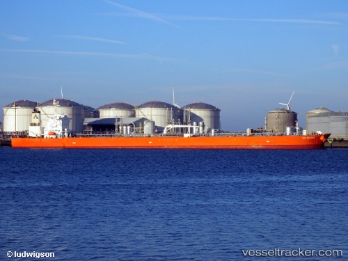
 POLARIS BAY
Current Status
Where is the vessel?
POLARIS BAY is currently in 76 nm E of SUR, based on AIS data received about 365d ago.
Latest AIS update:
Current position: 22.61420° N, 60.90256° E (76 nm E of SUR)
Average speed (last 7 days): Loading…
Average speed (last 30 days): Loading…
Vessel profile: POLARIS BAY is a Crude Oil Tanker with dimensions 42m x 244m.
This page combines live AIS, route history, probable destination signals, nearby traffic, and port activity for practical vessel monitoring.
The current position of vessel POLARIS BAY is 22.61420 lat / 60.90256 lng. Updated: 2025-04-08 02:14:11 UTCNearest reference points:
- 96 nm E of SUR
- 52 nm NE of SUR
- 120 nm E of SUR
Currently sailing under the flag of Liberia ![]()
POLARIS BAY built in 2008 year
Deadweight:
99997 tDetails:
Live Vessel POLARIS BAY Analytics (details, animations, etc.)
Recent AIS points (UTC):
2025-04-08 02:14:11 UTC · 22.61420, 60.90256 · SOG 18.5 kn · COG 142°