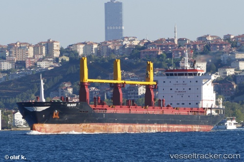
.
Vessel photo of STELLINA (IMO 9674933) vesseltracker.com

LR flag STELLINA

Vessel type: General Cargo Ship | IMO: 9674933 | MMSI: MMSI: 636021111
Call sign: 5LCI5 | Dimensions: 175 m x 17 m
Current Status

Where is the vessel?

STELLINA is currently in 74 nm SW of Hamtic, based on AIS data received about 85d ago.

Latest AIS update:

Current position: 9.89808° N, 121.00659° E (74 nm SW of Hamtic)

Average speed (last 7 days): Loading…

Average speed (last 30 days): Loading…

Vessel profile: STELLINA is a General Cargo Ship with dimensions 175m x 17m.

This page combines live AIS, route history, probable destination signals, nearby traffic, and port activity for practical vessel monitoring.

The current position of vessel STELLINA is 9.89808 lat / 121.00659 lng. Updated: 2026-01-18 13:59:04 UTC
Nearest reference points:
  • Near Iloilo
  • Near BACOLOD
  • 17 nm SW of Bacong

Currently sailing under the flag of Liberia LR flag

STELLINA built in 2014 year

Deadweight:
26052 t

Details:

Live Vessel STELLINA Analytics (details, animations, etc.)


Recent AIS points (UTC):
2026-01-18 13:59:04 UTC · 9.89808, 121.00659 · SOG 11.6 kn · COG 10°

Track of the vessel in the last 60 days


UTC: --
Start: -- Track timeline (UTC) End: --
Encountered: --


Link to the map:


Find another ship

STELLINA (636021111) last ports (portcalls and passsages)

Castellon | 2023-02-04 20:06:03
Ijmuiden | 2023-01-28 08:22:45
Amsterdam | 2023-01-28 02:51:20
Amsterdam | 2023-01-24 02:19:40
Ijmuiden | 2023-01-23 23:20:44
Takoradi | 2023-01-05 06:04:49
Takoradi | 2023-01-01 05:49:31
Takoradi | 2022-12-28 02:48:32
Takoradi | 2022-12-24 02:03:10
Dakar | 2022-12-16 23:37:52
Dakar | 2022-12-12 21:00:17
Puerto De La Luz | 2022-12-09 11:31:12
Strait Of Gibraltar | 2022-12-06 14:10:42
Uskudar | 2022-11-25 18:03:54
Poti | 2022-11-22 08:56:46
Poti | 2022-11-18 08:15:50
Canakkale | 2022-11-13 23:11:47
Cartagena | 2022-11-05 11:28:21
Cartagena | 2022-11-01 08:36:38
Cartagena | 2022-10-28 07:58:19
Cartagena | 2022-10-24 04:56:35