 vesseltracker.com
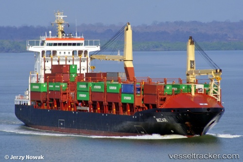
 MIZAR
MIZAR
Current Status
Where is the vessel?
MIZAR is currently in 14 nm W of Sociedad Portuaria Regional Cartagena, based on AIS data received about 1h ago.
Latest AIS update:
Current position: 10.47894° N, 75.75965° W (14 nm W of Sociedad Portuaria Regional Cartagena)
Average speed (last 7 days): Loading…
Average speed (last 30 days): Loading…
Vessel profile: MIZAR is a Container Ship with dimensions 26m x 162m.
This page combines live AIS, route history, probable destination signals, nearby traffic, and port activity for practical vessel monitoring.
The current position of vessel MIZAR is 10.47894 lat / -75.75965 lng. Updated: 2026-03-28 11:22:04 UTCNearest reference points:
- Near Sociedad Portuaria Regional Cartagena
- Near Contecar
- Near Santa Marta
Currently sailing under the flag of Liberia ![]()
MIZAR built in 2005 year
Deadweight:
17350 tDetails:
Live Vessel MIZAR Analytics (details, animations, etc.)
Recent AIS points (UTC):
2026-03-28 05:29:51 UTC · 10.24667, -76.68667 · SOG 9 kn · COG -1°2026-03-28 08:11:49 UTC · 10.30667, -76.27333 · SOG 9 kn · COG -1°
2026-03-28 10:02:20 UTC · 10.36692, -75.97381 · SOG 11.9 kn · COG 64°
2026-03-28 11:22:04 UTC · 10.47894, -75.75965 · SOG 9 kn · COG 59°