 vesseltracker.com
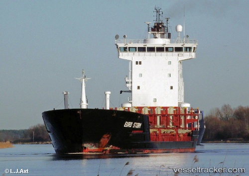
Vessel ELBE IMO: 9244180, MMSI: 636021322 Container Ship
UTC, 41.48477, 29.16628, course: -1, speed: 0.9
UTC, 41.43442, 29.18528, course: 284, speed: 1.5
2026-02-26 23:53:05 UTC, 41.39900, 29.20541, course: 268, speed: 1.5
Live AIS position:
UTC. 11 nm N of RUMELI FENERI),
updated 2026-02-26 23:53:05 UTC.
Find the position of the vessel ELBE on the map. The latter are known coordinates and path.
marine traffic ship tracker show on live map
The current position of vessel ELBE is 41.39900 lat / 29.20541 lng. Updated: 2026-02-26 23:53:05 UTCCurrently sailing under the flag of Liberia
ELBE built in 2001 year
Deadweight:
7992 tDetails:
Last coordinates of the vessel:
UTC, 42.11667, 29.34167, course: -1, speed: 11UTC, 41.48477, 29.16628, course: -1, speed: 0.9
UTC, 41.43442, 29.18528, course: 284, speed: 1.5
2026-02-26 23:53:05 UTC, 41.39900, 29.20541, course: 268, speed: 1.5