 vesseltracker.com
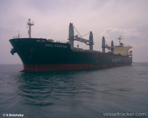
 SEA DESTINY
Current Status
Where is the vessel?
SEA DESTINY is currently in Near Santos, based on AIS data received about 1d ago.
Latest AIS update:
Current position: 23.97214° S, 46.29479° W (Near Santos)
Average speed (last 7 days): Loading…
Average speed (last 30 days): Loading…
Vessel profile: SEA DESTINY is a Bulk Carrier with dimensions 32m x 190m.
This page combines live AIS, route history, probable destination signals, nearby traffic, and port activity for practical vessel monitoring.
The current position of vessel SEA DESTINY is -23.97214 lat / -46.29479 lng. Updated: 2026-04-10 07:48:32 UTCNearest reference points:
- Near Guarujá
- Near Santos
- 30 nm SE of Guarujá
Currently sailing under the flag of Liberia ![]()
SEA DESTINY built in 2009 year
Deadweight:
55614 tDetails:
Live Vessel SEA DESTINY Analytics (details, animations, etc.)
Recent AIS points (UTC):
2026-04-10 02:04:59 UTC · -23.97219, -46.29474 · SOG 0 kn · COG 323°2026-04-10 03:25:56 UTC · -23.97217, -46.29473 · SOG 0 kn · COG 323°
2026-04-10 06:12:33 UTC · -23.97219, -46.29472 · SOG 0 kn · COG 323°
2026-04-10 07:48:32 UTC · -23.97214, -46.29479 · SOG 0 kn · COG 323°