 vesseltracker.com
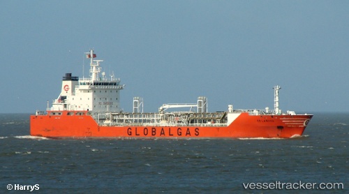
 IVI
IVI
Current Status
Where is the vessel?
IVI is currently in 43 nm SW of NECOCHEA, based on AIS data received about 1h ago.
Latest AIS update:
Current position: 39.09583° S, 59.35662° W (43 nm SW of NECOCHEA)
Average speed (last 7 days): Loading…
Average speed (last 30 days): Loading…
Vessel profile: IVI is a LPG Tanker with dimensions 119m x 119m.
This page combines live AIS, route history, probable destination signals, nearby traffic, and port activity for practical vessel monitoring.
The current position of vessel IVI is -39.09583 lat / -59.35662 lng. Updated: 2026-04-08 13:49:59 UTCNearest reference points:
- Near NECOCHEA
- Near Mar Del Plata
- 186 nm S of Quequen
Currently sailing under the flag of Liberia ![]()
IVI built in 2003 year
Deadweight:
7496 tDetails:
Live Vessel IVI Analytics (details, animations, etc.)
Recent AIS points (UTC):
2026-04-08 07:21:32 UTC · -38.67667, -57.74167 · SOG 11 kn · COG -1°2026-04-08 09:45:31 UTC · -38.87667, -58.30333 · SOG 12 kn · COG -1°
2026-04-08 11:52:49 UTC · -38.99038, -58.85604 · SOG 12.9 kn · COG 249°
2026-04-08 13:49:59 UTC · -39.09583, -59.35662 · SOG 12.2 kn · COG 251°