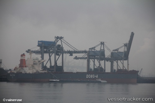
.
Vessel photo of CAPE AROLA (IMO 9452579) vesseltracker.com

LB flag CAPE AROLA

Vessel type: Bulk Carrier | IMO: 9452579 | MMSI: MMSI: 636021651
Call sign: 5LFA2 | Dimensions: 45 m x 292 m
Current Status

Where is the vessel?

CAPE AROLA is currently in 65 nm SE of Las Brujas, based on AIS data received about 2h ago.

Latest AIS update:

Current position: 23.04218° N, 17.31813° W (65 nm SE of Las Brujas)

Average speed (last 7 days): Loading…

Average speed (last 30 days): Loading…

Vessel profile: CAPE AROLA is a Bulk Carrier with dimensions 45m x 292m.

This page combines live AIS, route history, probable destination signals, nearby traffic, and port activity for practical vessel monitoring.

The current position of vessel CAPE AROLA is 23.04218 lat / -17.31813 lng. Updated: 2026-04-16 15:42:02 UTC
Nearest reference points:
  • 68 nm NW of Ad Dakhla
  • Near DAKHLA
  • 41 nm NW of Nouadhibou

Currently sailing under the flag of Liberia LB flag

CAPE AROLA built in 2009 year

Deadweight:
179329 t

Details:

Live Vessel CAPE AROLA Analytics (details, animations, etc.)


Recent AIS points (UTC):
2026-04-16 09:51:21 UTC · 22.13228, -17.56625 · SOG 9.8 kn · COG 11°
2026-04-16 11:53:22 UTC · 22.46127, -17.48553 · SOG 9.7 kn · COG 12°
2026-04-16 13:29:02 UTC · 22.71318, -17.42613 · SOG 9.5 kn · COG 15°
2026-04-16 15:42:02 UTC · 23.04218, -17.31813 · SOG 9.6 kn · COG 18°

Track of the vessel in the last 60 days


UTC: --
Start: -- Track timeline (UTC) End: --
Encountered: --


Link to the map:


Find another ship

CAPE_AROLA (636021651) last ports (portcalls and passsages)

Strait Of Gibraltar | 2025-07-13 20:19:46
CARTEYA GUADARRANQUE | 2025-07-12 20:16:37
Algeciras | 2025-07-12 18:24:20
DJEN DJEN | 2025-07-08 08:17:00
DJEN DJEN | 2025-07-04 07:57:45
DJEN DJEN | 2025-06-30 07:24:04
CARTEYA GUADARRANQUE | 2025-06-28 00:23:15
Strait Of Gibraltar | 2025-06-27 21:36:55
PULAU SAMBU | 2025-05-10 11:05:58
Singapore | 2025-05-09 22:27:56
TANAH MERAH | 2025-05-09 21:54:29
PENGERANG | 2025-05-09 19:54:59
PENGERANG | 2025-04-26 14:28:11
TANAH MERAH | 2025-04-26 01:09:48
PULAU SAMBU | 2025-04-26 00:00:24
PANGKOR | 2025-04-22 09:13:37
PULAU SAMBU | 2025-04-16 17:34:25
TANAH MERAH | 2025-04-16 16:26:23
DONGJIAKOU | 2025-04-05 03:10:59
TANAH MERAH | 2025-03-25 07:42:30
BATU AMPAR | 2025-03-25 07:05:34
PULAU SAMBU | 2025-03-25 05:53:55
Sebang | 2025-03-22 22:21:26
BUKOM ISLAND | 2025-01-11 17:08:24
PULAU SAMBU | 2025-01-11 16:26:36
TANAH MERAH | 2025-01-10 17:16:46
PENGERANG | 2025-01-10 14:22:46
Port Headland | 2024-12-12 19:18:06
Port Headland | 2024-11-22 01:25:38
Selat Lombok | 2024-08-27 00:05:07
Dampier | 2024-08-22 06:03:53
Selat Lombok | 2024-08-15 04:40:24
Rizhao | 2024-07-31 06:47:32
Sambu | 2024-07-18 20:26:21
Saldanha Bay | 2024-06-20 16:16:39
Saldanha Bay | 2024-06-16 06:36:17
Singapore | 2024-05-10 17:06:45
Singapore | 2024-03-30 02:51:21
Sebang | 2024-03-27 16:02:40
Sambu | 2024-01-19 17:54:44
Singapore | 2024-01-16 19:30:30
Sebang | 2023-12-06 06:21:09
Port Louis | 2023-11-20 12:09:08
Port Elizabeth | 2023-11-10 11:18:45
Port Elizabeth | 2023-09-12 04:54:25
Sambu | 2023-08-21 09:08:22
Singapore | 2023-08-20 15:36:47
Sambu | 2023-07-20 02:21:16
Sebang | 2023-07-17 03:54:25
Port Louis | 2023-07-03 14:18:57
Port Elizabeth | 2023-06-23 11:59:20
Port Elizabeth | 2023-04-24 19:35:15
Chibai | 2023-02-06 08:34:40
Chibai | 2023-01-31 06:07:45
Port Headland | 2023-01-13 00:04:53
Yosu | 2022-05-11 22:28:55
Selat Lombok | 2022-04-16 18:09:08
Port Headland | 2022-02-28 18:55:26
Selat Lombok | 2022-01-05 09:05:00
Port Headland | 2022-01-01 07:21:08
Selat Lombok | 2021-12-26 17:36:51
Taku Bar | 2021-12-16 02:36:21
Dagu Bar | 2021-12-13 16:29:46
Taku Bar | 2021-12-13 15:27:13