 vesseltracker.com
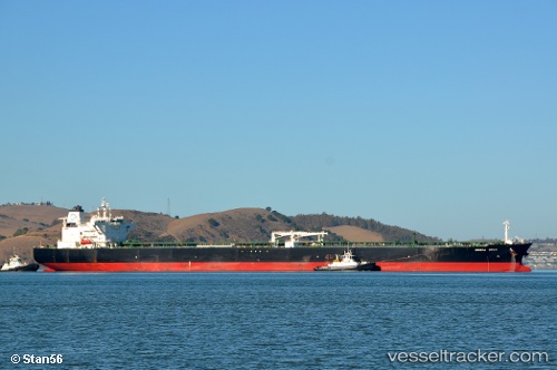
 DELTA BLUE
Current Status
Where is the vessel?
DELTA BLUE is currently in Near Punta Cugno, based on AIS data received less than 1h ago.
Latest AIS update:
Current position: 37.20252° N, 15.20388° E (Near Punta Cugno)
Average speed (last 7 days): Loading…
Average speed (last 30 days): Loading…
Vessel profile: DELTA BLUE is a Crude Oil Tanker with dimensions 48m x 274m.
This page combines live AIS, route history, probable destination signals, nearby traffic, and port activity for practical vessel monitoring.
The current position of vessel DELTA BLUE is 37.20252 lat / 15.20388 lng. Updated: 2026-04-06 10:07:06 UTCNearest reference points:
- Near Punta Cugno
- Near Augusta
- Near Pier Isab
Currently sailing under the flag of Liberia ![]()
DELTA BLUE built in 2012 year
Deadweight:
158322 tDetails:
Live Vessel DELTA BLUE Analytics (details, animations, etc.)
Recent AIS points (UTC):
2026-04-06 03:55:04 UTC · 37.20067, 15.20754 · SOG 0 kn · COG 338°2026-04-06 05:25:05 UTC · 37.20042, 15.20643 · SOG 0 kn · COG 0°
2026-04-06 07:58:06 UTC · 37.20081, 15.20502 · SOG 0 kn · COG 34°
2026-04-06 10:07:06 UTC · 37.20252, 15.20388 · SOG 0 kn · COG 87°