 vesseltracker.com
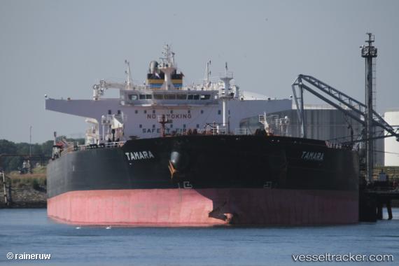
 TAMARA
Current Status
Where is the vessel?
TAMARA is currently in 23 nm SW of Megálon Livádion, based on AIS data received about 1h ago.
Latest AIS update:
Current position: 36.94629° N, 24.01899° E (23 nm SW of Megálon Livádion)
Average speed (last 7 days): Loading…
Average speed (last 30 days): Loading…
Vessel profile: TAMARA is a Crude Oil Tanker with dimensions 275m x 48m.
This page combines live AIS, route history, probable destination signals, nearby traffic, and port activity for practical vessel monitoring.
The current position of vessel TAMARA is 36.94629 lat / 24.01899 lng. Updated: 2026-04-18 06:13:12 UTCNearest reference points:
- 17 nm W of Milos (Adamas)
- Near Kéa (Tzia)
- Near Methana
Currently sailing under the flag of Liberia ![]()
TAMARA built in 2015 year
Deadweight:
157016 tDetails:
Live Vessel TAMARA Analytics (details, animations, etc.)
Recent AIS points (UTC):
2026-04-17 23:55:56 UTC · 36.26244, 24.92711 · SOG 9.9 kn · COG 304°2026-04-18 01:50:05 UTC · 36.41967, 24.59301 · SOG 10.1 kn · COG 306°
2026-04-18 04:03:05 UTC · 36.63331, 24.20408 · SOG 9.5 kn · COG 337°
2026-04-18 06:13:12 UTC · 36.94629, 24.01899 · SOG 9.9 kn · COG 345°