 vesseltracker.com
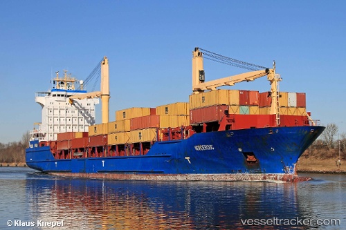
Vessel MSC NORDEROOG F IMO: 9256315, MMSI: 636021914 Container Ship
UTC, 26.43363, -78.45871, course: 117, speed: 0.1
UTC, 26.43582, -78.46224, course: 151, speed: 0.2
2026-03-01 00:34:19 UTC, 26.41172, -78.46575, course: 158, speed: 0.3
Live AIS position:
UTC. 11 nm SE of Lucaya),
updated 2026-03-01 00:34:19 UTC.
Find the position of the vessel MSC NORDEROOG F on the map. The latter are known coordinates and path.
marine traffic ship tracker show on live map
The current position of vessel MSC NORDEROOG F is 26.41172 lat / -78.46575 lng. Updated: 2026-03-01 00:34:19 UTCCurrently sailing under the flag of Liberia
MSC NORDEROOG F built in 2004 year
Deadweight:
16921 tDetails:
Last coordinates of the vessel:
UTC, 26.42866, -78.45757, course: 124, speed: 0.3UTC, 26.43363, -78.45871, course: 117, speed: 0.1
UTC, 26.43582, -78.46224, course: 151, speed: 0.2
2026-03-01 00:34:19 UTC, 26.41172, -78.46575, course: 158, speed: 0.3