 vesseltracker.com
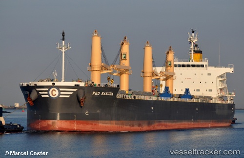
 RED SAKURA
Current Status
Where is the vessel?
RED SAKURA is currently in 282 nm SW of Monrovia, based on AIS data received less than 1h ago.
Latest AIS update:
Current position: 2.88126° N, 14.01350° W (282 nm SW of Monrovia)
Average speed (last 7 days): Loading…
Average speed (last 30 days): Loading…
Vessel profile: RED SAKURA is a Bulk Carrier with dimensions 32m x 200m.
This page combines live AIS, route history, probable destination signals, nearby traffic, and port activity for practical vessel monitoring.
The current position of vessel RED SAKURA is 2.88126 lat / -14.01350 lng. Updated: 2026-04-21 23:54:05 UTCNearest reference points:
- Open sea, approx. 402 nm off the nearest listed port
- Open sea, approx. 405 nm off the nearest listed port
- Open sea, approx. 406 nm off the nearest listed port
Currently sailing under the flag of Liberia ![]()
RED SAKURA built in 2017 year
Deadweight:
60245 tDetails:
Live Vessel RED SAKURA Analytics (details, animations, etc.)
Recent AIS points (UTC):
2026-04-21 19:23:23 UTC · 3.54688, -14.55286 · SOG 11.8 kn · COG 138°2026-04-21 21:28:51 UTC · 3.23409, -14.29730 · SOG 11 kn · COG 139°
2026-04-21 22:33:15 UTC · 3.08024, -14.17339 · SOG 11.1 kn · COG 140°
2026-04-21 23:54:05 UTC · 2.88126, -14.01350 · SOG 11.4 kn · COG 139°