 vesseltracker.com
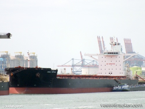
 PANTARISTE
Current Status
Where is the vessel?
PANTARISTE is currently in 57 nm NE of Sabahat, based on AIS data received about 8h ago.
Latest AIS update:
Current position: 5.64024° N, 119.80083° E (57 nm NE of Sabahat)
Average speed (last 7 days): Loading…
Average speed (last 30 days): Loading…
Vessel profile: PANTARISTE is a Bulk Carrier with dimensions 45m x 290m.
This page combines live AIS, route history, probable destination signals, nearby traffic, and port activity for practical vessel monitoring.
The current position of vessel PANTARISTE is 5.64024 lat / 119.80083 lng. Updated: 2026-04-07 21:31:30 UTCNearest reference points:
- 66 nm W of Jolo
- 80 nm SE of Labuan Haji
- 43 nm E of Sibuko Bay
Currently sailing under the flag of Liberia ![]()
PANTARISTE built in 2011 year
Deadweight:
169097 tDetails:
Live Vessel PANTARISTE Analytics (details, animations, etc.)
Recent AIS points (UTC):
2026-04-07 20:04:17 UTC · 5.35804, 119.72149 · SOG 12.5 kn · COG -1°2026-04-07 21:31:30 UTC · 5.64024, 119.80083 · SOG 11.7 kn · COG -1°
2026-04-07 21:31:30 UTC · 5.64024, 119.80083 · SOG 11.7 kn · COG -1°
2026-04-07 21:31:30 UTC · 5.64024, 119.80083 · SOG 11.7 kn · COG -1°