 vesseltracker.com
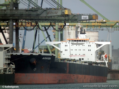
 AIGAION
Current Status
Where is the vessel?
AIGAION is currently in Near Malacca, based on AIS data received about 1h ago.
Latest AIS update:
Current position: 2.02988° N, 102.15057° E (Near Malacca)
Average speed (last 7 days): Loading…
Average speed (last 30 days): Loading…
Vessel profile: AIGAION is a Bulk Carrier with dimensions m x m.
This page combines live AIS, route history, probable destination signals, nearby traffic, and port activity for practical vessel monitoring.
The current position of vessel AIGAION is 2.02988 lat / 102.15057 lng. Updated: 2026-04-18 03:29:58 UTCNearest reference points:
- Near Malacca
- Near SUNGAI UDANG
- Near MELAKA
Currently sailing under the flag of Liberia ![]()
Details:
Live Vessel AIGAION Analytics (details, animations, etc.)
Recent AIS points (UTC):
2026-04-17 21:24:27 UTC · 1.39715, 103.20320 · SOG 13.8 kn · COG 307°2026-04-17 23:36:07 UTC · 1.68077, 102.80773 · SOG 12 kn · COG 296°
2026-04-18 02:16:27 UTC · 1.88737, 102.35102 · SOG 11.6 kn · COG 295°
2026-04-18 03:29:58 UTC · 2.02988, 102.15057 · SOG 12.9 kn · COG 310°