 vesseltracker.com
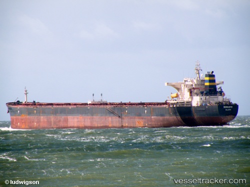
 ROBUSTO
Current Status
Where is the vessel?
ROBUSTO is currently in 87 nm W of Saldanha Bay, based on AIS data received about 1d ago.
Latest AIS update:
Current position: 32.91133° S, 16.15519° E (87 nm W of Saldanha Bay)
Average speed (last 7 days): Loading…
Average speed (last 30 days): Loading…
Vessel profile: ROBUSTO is a Bulk Carrier with dimensions m x m.
This page combines live AIS, route history, probable destination signals, nearby traffic, and port activity for practical vessel monitoring.
The current position of vessel ROBUSTO is -32.91133 lat / 16.15519 lng. Updated: 2026-04-10 06:59:46 UTCNearest reference points:
- 116 nm SW of Saldanha Bay
- 111 nm W of Kommetjie
- Near Saint Helena Bay
Currently sailing under the flag of Liberia ![]()
Details:
Live Vessel ROBUSTO Analytics (details, animations, etc.)
Recent AIS points (UTC):
2026-04-10 02:24:58 UTC · -32.44412, 15.38554 · SOG 10.4 kn · COG 123°2026-04-10 03:50:07 UTC · -32.58904, 15.62259 · SOG 10.3 kn · COG 121°
2026-04-10 05:49:17 UTC · -32.79167, 15.95667 · SOG 10 kn · COG -1°
2026-04-10 06:59:46 UTC · -32.91133, 16.15519 · SOG 10.3 kn · COG 125°