 vesseltracker.com
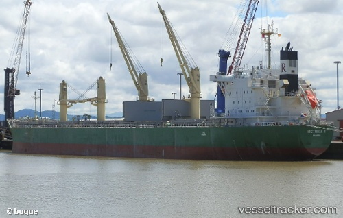
 VICTORIA T
Current Status
Where is the vessel?
VICTORIA T is currently in 129 nm N of Cockburn Town, based on AIS data received less than 1h ago.
Latest AIS update:
Current position: 26.08573° N, 73.83335° W (129 nm N of Cockburn Town)
Average speed (last 7 days): Loading…
Average speed (last 30 days): Loading…
Vessel profile: VICTORIA T is a Cargo with dimensions m x m.
This page combines live AIS, route history, probable destination signals, nearby traffic, and port activity for practical vessel monitoring.
The current position of vessel VICTORIA T is 26.08573 lat / -73.83335 lng. Updated: 2026-04-19 15:20:22 UTCNearest reference points:
- 31 nm E of Harbour Island
- 22 nm E of Harbour Island
- 113 nm NE of Green Turtle Cay
Currently sailing under the flag of Liberia ![]()
Details:
Live Vessel VICTORIA T Analytics (details, animations, etc.)
Recent AIS points (UTC):
2026-04-19 10:50:33 UTC · 26.19055, -72.92151 · SOG 11.4 kn · COG 262°2026-04-19 13:27:12 UTC · 26.12900, -73.45749 · SOG 11.2 kn · COG 266°
2026-04-19 13:27:12 UTC · 26.12900, -73.45749 · SOG 11.2 kn · COG 266°
2026-04-19 15:20:22 UTC · 26.08573, -73.83335 · SOG 10.4 kn · COG 263°