 vesseltracker.com
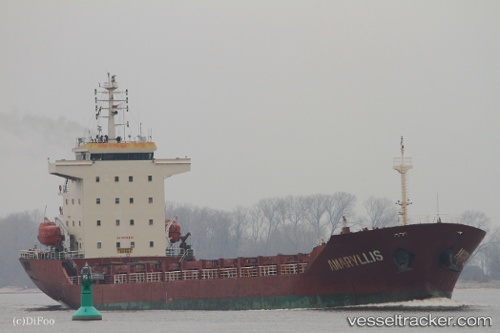
 CELIK 1
Current Status
Where is the vessel?
CELIK 1 is currently in 41 nm NW of TENES, based on AIS data received about 1h ago.
Latest AIS update:
Current position: 36.81830° N, 0.54197° E (41 nm NW of TENES)
Average speed (last 7 days): Loading…
Average speed (last 30 days): Loading…
Vessel profile: CELIK 1 is a General Cargo with dimensions m x m.
This page combines live AIS, route history, probable destination signals, nearby traffic, and port activity for practical vessel monitoring.
The current position of vessel CELIK 1 is 36.81830 lat / 0.54197 lng. Updated: 2026-04-17 12:24:06 UTCNearest reference points:
- 50 nm N of Mostaganem
- 43 nm NW of Mostaganem
- Near Mostaganem
Currently sailing under the flag of Liberia ![]()
Details:
Live Vessel CELIK 1 Analytics (details, animations, etc.)
Recent AIS points (UTC):
2026-04-17 07:24:26 UTC · 36.55804, -0.38969 · SOG 9 kn · COG 70°2026-04-17 09:50:07 UTC · 36.69664, 0.06166 · SOG 10.1 kn · COG 71°
2026-04-17 10:10:48 UTC · 36.71669, 0.12815 · SOG 9.8 kn · COG 65°
2026-04-17 12:24:06 UTC · 36.81830, 0.54197 · SOG 8.8 kn · COG 78°