 vesseltracker.com
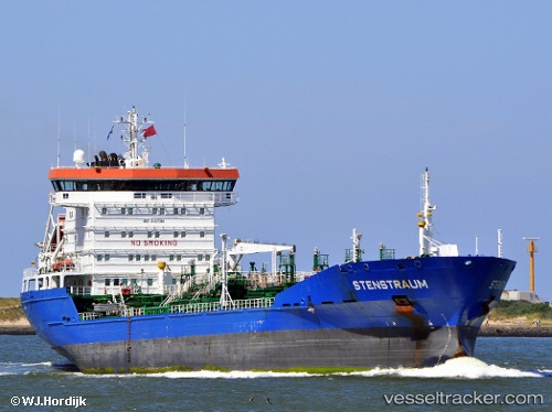
 STENSTRAUM
Current Status
Where is the vessel?
STENSTRAUM is currently in 34 nm SE of Shanwai, based on AIS data received about 1h ago.
Latest AIS update:
Current position: 27.77667° N, 121.76667° E (34 nm SE of Shanwai)
Average speed (last 7 days): Loading…
Average speed (last 30 days): Loading…
Vessel profile: STENSTRAUM is a Oil/Chemical Tanker with dimensions m x m.
This page combines live AIS, route history, probable destination signals, nearby traffic, and port activity for practical vessel monitoring.
The current position of vessel STENSTRAUM is 27.77667 lat / 121.76667 lng. Updated: 2026-03-29 23:17:11 UTCNearest reference points:
- 27 nm E of Shanwai
- 36 nm SE of Zhuangyuanao
- 27 nm SE of Zhuangyuanao
Currently sailing under the flag of Liberia ![]()
Details:
Live Vessel STENSTRAUM Analytics (details, animations, etc.)
Recent AIS points (UTC):
2026-03-29 17:25:20 UTC · 28.70333, 122.43667 · SOG 12 kn · COG -1°2026-03-29 19:49:42 UTC · 28.31667, 122.16500 · SOG 11 kn · COG -1°
2026-03-29 22:04:14 UTC · 27.96437, 121.91749 · SOG 10.7 kn · COG 212°
2026-03-29 23:17:11 UTC · 27.77667, 121.76667 · SOG 11 kn · COG -1°