 vesseltracker.com
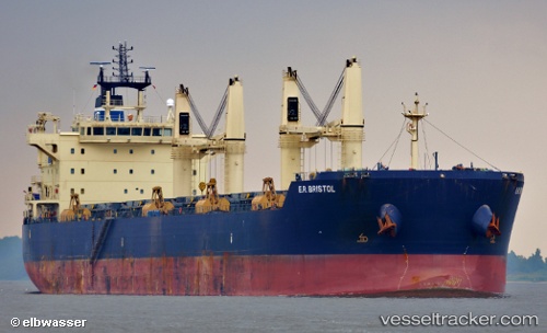
 BRISTOL
Current Status
Where is the vessel?
BRISTOL is currently in Near Damietta, based on AIS data received less than 1h ago.
Latest AIS update:
Current position: 31.46311° N, 31.76707° E (Near Damietta)
Average speed (last 7 days): Loading…
Average speed (last 30 days): Loading…
Vessel profile: BRISTOL is a Bulk Carrier with dimensions m x m.
This page combines live AIS, route history, probable destination signals, nearby traffic, and port activity for practical vessel monitoring.
The current position of vessel BRISTOL is 31.46311 lat / 31.76707 lng. Updated: 2026-04-18 19:54:10 UTCNearest reference points:
- Near Damietta
- 21 nm N of Port Said
- 15 nm N of Port Said
Currently sailing under the flag of Liberia ![]()
Details:
Live Vessel BRISTOL Analytics (details, animations, etc.)
Recent AIS points (UTC):
2026-04-18 13:57:13 UTC · 31.46319, 31.76709 · SOG 0 kn · COG 225°2026-04-18 16:24:12 UTC · 31.46315, 31.76707 · SOG 0 kn · COG 225°
2026-04-18 17:51:17 UTC · 31.46310, 31.76706 · SOG 0 kn · COG 225°
2026-04-18 19:54:10 UTC · 31.46311, 31.76707 · SOG 0 kn · COG 225°