 vesseltracker.com
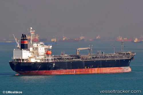
 SEA GULL
Current Status
Where is the vessel?
SEA GULL is currently in 138 nm NW of Upper Northfield, based on AIS data received less than 1h ago.
Latest AIS update:
Current position: 22.57497° N, 47.26953° W (138 nm NW of Upper Northfield)
Average speed (last 7 days): Loading…
Average speed (last 30 days): Loading…
Vessel profile: SEA GULL is a Oil/Chemical Tanker with dimensions m x m.
This page combines live AIS, route history, probable destination signals, nearby traffic, and port activity for practical vessel monitoring.
The current position of vessel SEA GULL is 22.57497 lat / -47.26953 lng. Updated: 2026-04-16 13:55:02 UTCCurrently sailing under the flag of Liberia ![]()
Details:
Live Vessel SEA GULL Analytics (details, animations, etc.)
Recent AIS points (UTC):
2026-04-16 07:57:42 UTC · 23.05574, -45.97082 · SOG 13.3 kn · COG 247°2026-04-16 09:54:51 UTC · 22.90139, -46.39983 · SOG 13.2 kn · COG 248°
2026-04-16 12:05:40 UTC · 22.72149, -46.87103 · SOG 13.2 kn · COG 248°
2026-04-16 13:55:02 UTC · 22.57497, -47.26953 · SOG 13.1 kn · COG 247°