 vesseltracker.com
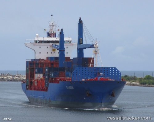
 DUBAI TOWER
Current Status
Where is the vessel?
DUBAI TOWER is currently in 73 nm SW of Al Qahmah, based on AIS data received about 1h ago.
Latest AIS update:
Current position: 17.27155° N, 40.65657° E (73 nm SW of Al Qahmah)
Average speed (last 7 days): Loading…
Average speed (last 30 days): Loading…
Vessel profile: DUBAI TOWER is a Container Ship with dimensions m x m.
This page combines live AIS, route history, probable destination signals, nearby traffic, and port activity for practical vessel monitoring.
The current position of vessel DUBAI TOWER is 17.27155 lat / 40.65657 lng. Updated: 2026-04-21 19:53:56 UTCNearest reference points:
- 92 nm SW of Al Qahmah
- Near Jazan Economic City
- 81 nm NW of As Salif
Currently sailing under the flag of Liberia ![]()
Details:
Live Vessel DUBAI TOWER Analytics (details, animations, etc.)
Recent AIS points (UTC):
2026-04-21 16:37:15 UTC · 16.50970, 41.05857 · SOG 15.9 kn · COG 333°2026-04-21 17:23:42 UTC · 16.68912, 40.95692 · SOG 15.5 kn · COG 331°
2026-04-21 19:50:56 UTC · 17.25958, 40.66223 · SOG 15.7 kn · COG 336°
2026-04-21 19:53:56 UTC · 17.27155, 40.65657 · SOG 15.7 kn · COG 336°