 vesseltracker.com
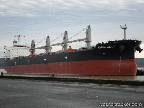
 ANNA MARIA
Current Status
Where is the vessel?
ANNA MARIA is currently in 27 nm NW of Lokken, based on AIS data received about 1h ago.
Latest AIS update:
Current position: 57.64089° N, 9.04865° E (27 nm NW of Lokken)
Average speed (last 7 days): Loading…
Average speed (last 30 days): Loading…
Vessel profile: ANNA MARIA is a Bulk Carrier with dimensions m x m.
This page combines live AIS, route history, probable destination signals, nearby traffic, and port activity for practical vessel monitoring.
The current position of vessel ANNA MARIA is 57.64089 lat / 9.04865 lng. Updated: 2026-04-18 04:19:34 UTCNearest reference points:
- 28 nm NW of Lokken
- 27 nm N of HANSTHOLM
- Near HANSTHOLM
Currently sailing under the flag of Liberia ![]()
Details:
Live Vessel ANNA MARIA Analytics (details, animations, etc.)
Recent AIS points (UTC):
2026-04-17 21:48:34 UTC · 57.70556, 10.81349 · SOG 11.3 kn · COG 74°2026-04-18 00:01:03 UTC · 57.84800, 10.44697 · SOG 11.5 kn · COG 269°
2026-04-18 02:30:18 UTC · 57.82013, 9.56683 · SOG 10.8 kn · COG 240°
2026-04-18 04:19:34 UTC · 57.64089, 9.04865 · SOG 10.9 kn · COG 237°