 vesseltracker.com
 SMOOTH SAILING
Current Status
Where is the vessel?
SMOOTH SAILING is currently in 15 nm S of Subic Bay, based on AIS data received about 8h ago.
Latest AIS update:
Current position: 14.47615° N, 120.24522° E (15 nm S of Subic Bay)
Average speed (last 7 days): Loading…
Average speed (last 30 days): Loading…
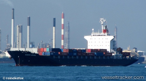
Vessel profile: SMOOTH SAILING is a Container Ship with dimensions m x m.
This page combines live AIS, route history, probable destination signals, nearby traffic, and port activity for practical vessel monitoring.
The current position of vessel SMOOTH SAILING is 14.47615 lat / 120.24522 lng. Updated: 2026-04-10 08:26:58 UTCNearest reference points:
- 19 nm SW of MARIVELES
- Near Nasugbu, Luzon
- Near Noveleta
Currently sailing under the flag of Liberia ![]()
Details:
Live Vessel SMOOTH SAILING Analytics (details, animations, etc.)
Recent AIS points (UTC):
2026-04-10 01:48:32 UTC · 14.60078, 120.95235 · SOG 0.1 kn · COG 79°2026-04-10 03:57:32 UTC · 14.60073, 120.95240 · SOG 0 kn · COG 79°
2026-04-10 05:43:53 UTC · 14.58015, 120.84385 · SOG 13.7 kn · COG 245°
2026-04-10 08:26:58 UTC · 14.47615, 120.24522 · SOG 14.1 kn · COG 308°