 vesseltracker.com
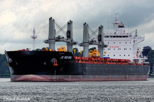
 STAR ROWAYTON
Current Status
Where is the vessel?
STAR ROWAYTON is currently in Open sea, approx. 422 nm off the nearest listed port, based on AIS data received less than 1h ago.
Latest AIS update:
Current position: 4.83274° N, 63.39285° E (Open sea, approx. 422 nm off the nearest listed port)
Average speed (last 7 days): Loading…
Average speed (last 30 days): Loading…
Vessel profile: STAR ROWAYTON is a Bulk Carrier with dimensions m x m.
This page combines live AIS, route history, probable destination signals, nearby traffic, and port activity for practical vessel monitoring.
The current position of vessel STAR ROWAYTON is 4.83274 lat / 63.39285 lng. Updated: 2026-04-20 10:24:43 UTCNearest reference points:
- Open sea, approx. 422 nm off the nearest listed port
- Open sea, approx. 415 nm off the nearest listed port
- Open sea, approx. 428 nm off the nearest listed port
Currently sailing under the flag of Liberia ![]()
Details:
Live Vessel STAR ROWAYTON Analytics (details, animations, etc.)
Recent AIS points (UTC):
2026-04-20 06:46:57 UTC · 5.50816, 63.73083 · SOG 12.4 kn · COG 205°2026-04-20 07:53:13 UTC · 5.30129, 63.62645 · SOG 12.6 kn · COG 203°
2026-04-20 10:15:55 UTC · 4.85977, 63.40697 · SOG 12.6 kn · COG 206°
2026-04-20 10:24:43 UTC · 4.83274, 63.39285 · SOG 12.4 kn · COG 206°