 vesseltracker.com
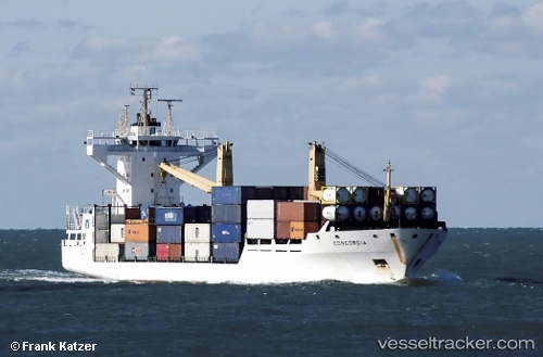
 KINGSTON TRADER
Current Status
Where is the vessel?
KINGSTON TRADER is currently in 14 nm SW of Carriacou Apt, based on AIS data received about 2h ago.
Latest AIS update:
Current position: 12.33629° N, 61.66513° W (14 nm SW of Carriacou Apt)
Average speed (last 7 days): Loading…
Average speed (last 30 days): Loading…
Vessel profile: KINGSTON TRADER is a Container Ship with dimensions m x m.
This page combines live AIS, route history, probable destination signals, nearby traffic, and port activity for practical vessel monitoring.
The current position of vessel KINGSTON TRADER is 12.33629 lat / -61.66513 lng. Updated: 2026-04-18 21:35:16 UTCNearest reference points:
- 16 nm SW of Carriacou Apt
- Near St. Georges
- Near ST GEORGES
Currently sailing under the flag of Liberia ![]()
Details:
Live Vessel KINGSTON TRADER Analytics (details, animations, etc.)
Recent AIS points (UTC):
2026-04-18 16:14:53 UTC · 12.04917, -61.75058 · SOG 0 kn · COG 160°2026-04-18 17:44:42 UTC · 12.04915, -61.75057 · SOG 0 kn · COG 160°
2026-04-18 19:50:42 UTC · 12.04917, -61.75061 · SOG 0.1 kn · COG 162°
2026-04-18 21:35:16 UTC · 12.33629, -61.66513 · SOG 12.3 kn · COG 68°