 vesseltracker.com
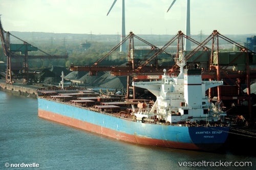
 LILA LESVOS
Current Status
Where is the vessel?
LILA LESVOS is currently in 360 nm NE of Levelwood, based on AIS data received less than 1h ago.
Latest AIS update:
Current position: 10.78398° S, 1.43537° W (360 nm NE of Levelwood)
Average speed (last 7 days): Loading…
Average speed (last 30 days): Loading…
Vessel profile: LILA LESVOS is a Bulk Carrier with dimensions m x m.
This page combines live AIS, route history, probable destination signals, nearby traffic, and port activity for practical vessel monitoring.
The current position of vessel LILA LESVOS is -10.78398 lat / -1.43537 lng. Updated: 2026-04-12 19:52:05 UTCNearest reference points:
- 347 nm NE of Levelwood
- Open sea, approx. 402 nm off the nearest listed port
- Open sea, approx. 401 nm off the nearest listed port
Currently sailing under the flag of Liberia ![]()
Details:
Live Vessel LILA LESVOS Analytics (details, animations, etc.)
Recent AIS points (UTC):
2026-04-12 14:20:55 UTC · -10.03852, -1.96660 · SOG 9.5 kn · COG 139°2026-04-12 16:07:07 UTC · -10.27188, -1.79705 · SOG 9.7 kn · COG 143°
2026-04-12 18:16:45 UTC · -10.56353, -1.59090 · SOG 9.9 kn · COG 144°
2026-04-12 19:52:05 UTC · -10.78398, -1.43537 · SOG 10 kn · COG 144°