 vesseltracker.com
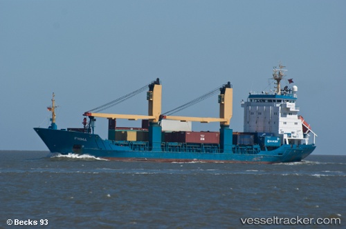
 XIN HAI TONG 501
Current Status
Where is the vessel?
XIN HAI TONG 501 is currently in Near Vishakhapatnam, based on AIS data received less than 1h ago.
Latest AIS update:
Current position: 17.69507° N, 83.28020° E (Near Vishakhapatnam)
Average speed (last 7 days): Loading…
Average speed (last 30 days): Loading…
Vessel profile: XIN HAI TONG 501 is a General Cargo with dimensions m x m.
This page combines live AIS, route history, probable destination signals, nearby traffic, and port activity for practical vessel monitoring.
The current position of vessel XIN HAI TONG 501 is 17.69507 lat / 83.28020 lng. Updated: 2026-04-22 13:58:02 UTCNearest reference points:
- Near Vishakhapatnam
- Near Wipro Sez/Resapuvanipalem
- Near Gopalpur
Currently sailing under the flag of Liberia ![]()
Details:
Live Vessel XIN HAI TONG 501 Analytics (details, animations, etc.)
Recent AIS points (UTC):
2026-04-22 10:43:01 UTC · 17.69512, 83.28022 · SOG 0 kn · COG 84°2026-04-22 11:40:02 UTC · 17.69512, 83.28021 · SOG 0 kn · COG 88°
2026-04-22 13:25:02 UTC · 17.69512, 83.28022 · SOG 0 kn · COG 85°
2026-04-22 13:58:02 UTC · 17.69507, 83.28020 · SOG 0 kn · COG 84°