 vesseltracker.com
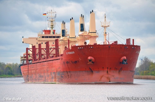
 WEST HARMONY
Current Status
Where is the vessel?
WEST HARMONY is currently in Near Port Manatee, based on AIS data received less than 1h ago.
Latest AIS update:
Current position: 27.71012° N, 82.54505° W (Near Port Manatee)
Average speed (last 7 days): Loading…
Average speed (last 30 days): Loading…
Vessel profile: WEST HARMONY is a Bulk Carrier with dimensions m x m.
This page combines live AIS, route history, probable destination signals, nearby traffic, and port activity for practical vessel monitoring.
The current position of vessel WEST HARMONY is 27.71012 lat / -82.54505 lng. Updated: 2026-04-19 17:34:27 UTCNearest reference points:
- Near St. Petersburg
- Near Port Manatee
- Near Saint Petersburg
Currently sailing under the flag of Liberia ![]()
Details:
Live Vessel WEST HARMONY Analytics (details, animations, etc.)
Recent AIS points (UTC):
2026-04-19 14:14:55 UTC · 27.61891, -82.97220 · SOG 0 kn · COG 319°2026-04-19 15:32:36 UTC · 27.61607, -82.96010 · SOG 9.5 kn · COG 125°
2026-04-19 16:36:56 UTC · 27.60430, -82.73787 · SOG 11.2 kn · COG 84°
2026-04-19 17:34:27 UTC · 27.71012, -82.54505 · SOG 13.6 kn · COG 33°